A B C D E F G H I J K L M N O P Q R S T U V W X Y Z
Introduction
[<Previous Page] [Next Page>]
Labothie Hill (NO 473417, 232m)
Gaelic leth bothan “hillside of the hut” or lathach bothan “swampy place of the hut”
Location: Outlier, east
Neighbours: Carrot Hill (SW), Gallow Hill (E)
Summit: moorland, with many old tree stumps;a ridge with the unmarked highest point in the middle; two large grass-covered prehistoric cairns lie at the ends of the ridge, Hatton Cairn at the west end, and another at the east end, near a telecommunications mast and a World War II Type 27 antiaircaft pillbox, related to the Douglas Wood Chain Home Radar station the remains of which spreads over the southeast slope of Labothie Hill (the receiving station) and on to Gallow Hill (the transmitting station)
Notes: above Labothie farm; the mound of Hare Cairn, another prehistoric cairn, is on the southeast slope, above Harecairn transmission mast and the remains of the Douglas Wood Chain Home Radar receiving station

Summit of Labothie Hill looking towards Fothringham Hill

A modern cairn sits on top of the grassy mound of prehistoric Hatton Cairn at the west end of the Labothie Hill ridge; Carrot Hill is on the sky line

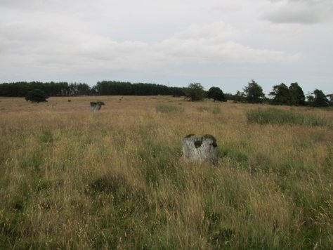
Summit ridge of Lobothie Hill, with numerous tree stumps

Transmission mast and WWII pillbox at the east end of Labothie Hill; the mound between the two is the central core of a prehistoric cairn

View of the telecommunication mast at the east end of Labothie Hill ridge

View of the pillbox at the east end of Labothie Hill ridge

The grassy mound of Hare Cairn on Labothie Hill; Harecairn telecommunication mast in background

Harecairn telecommunication antenna on the southeastern slope of Labothie Hill

Remains of Douglas Wood Chain Home Radar receiving station on the southeastern slope of Labothie Hill; Harecairn transmission mast is in the background

Labothie Hill from the northwest
Laidloon Hill (NO 393420, 312m)
Gaelic leathad lunnd, “slope of the marsh”, perhaps from the marshy ground on its west side (now extensively drained)
Location: main ridge, east central
Neighbours: Gallow Hill (S), Broom Hill (W)
Summit: heather, small cairn

Summit of Laidloon Hill; Broom Hill is in the middle distance and the Ark Hill – Berry Hillock ridge forms the sky-line

Laidloon Hill (heather covered) seen from Ironside Hill; Berry Hillock is beyond (grassy)

Laidloon Hill (left) and Gallow Hill (right, with mast) from Glen Ogilvie
Lintrose Hill (NO 234343, 325m)
Gaelic linne ros, “pool at the wood or point”; emphasis on second syllable
Location: main ridge, west
Neighbours: Buttergask Hill (W), Gask Hill (NE)
Summit: moorland, small cairn
Notes: some distance from Lintrose House and Lintrose Den

Summit of Lintrose Hill, looking towards King’s Seat (left) and Black Hill (distant, right)

Lintrose Hill (middle distance, grass and heather) from Buttergask Hill; Gask Hill (forestry) is beyond
Little Dunsinane (NO 224325, 295m)
English little + Gaelic dun na sine, “hill fort of the little breast”, from the hill’s shape, or perhaps a personal name; pronounced dun-SIN-in; since there is no hill fort on this hill, probably a reference to nearby Dunsinane Hill, which similarly stands above a hill pass
Location: main ridge, west
Neighbours: King’s Seat (NE), Black Hill (SW)
Summit: moorland
Notes: the remains of a broch on the SW slope are recognizable only as a symmetrical mound

Summit of Little Dunsinane, looking towards the lochan below Black Hill

Little Dunsinane from the lochan between Black Hill and King’s Seat

The remains of the broch below Little Dunsinane
Lorns Hill (NO 443399, 243m)
Unknown etymology
Location: outlier, east
Neighbours: Dodd Hill (E)
Summit: heather

Summit of Lorns Hill, looking towards Craigowl (left, with masts), Gallow Hill and Ironside Hill (centre, heather) and Finlarg Hill (right of centre, grqssy)

Lorns Hill from the north
Lour, Hill of (NO 472462, 232m)
Gaelic labhar, “loud” (usually a stream name); pronounced LOOR
Location: outlier, east
Neighbours: Fothringham Hill (SW)
Summit: pasture; walled folly named “The Temple”, several graves within its precincts
Notes: above the Lour estate

The “Temple” on Hill of Lour

Summit of Hill of Lour

Gravestone within precinct of Hill of Lour “Temple”

Hill of Lour from the northeast; “The Temple” is just visible through the trees
Lundie Craigs (NO 280378, 353m)
Gaelic lunnd, “marsh” + Scots craigs, “crags”
Location: main ridge, west central
Neighbours: Ardgarth Hill (SW), Keillor Hill (N), Palmer Hill (E)
Hill Lists: HuMP, Tump
Summit: moorland; triangulation pillar; telecommunication tower and access track a short distance to the west
Notes: above village of Lundie; “craigs” refers to the line of south-facing crags which terminate just west of the triangulation pillar

Summit of Lundie Craigs

Lundie Craigs from Ardgarth Hill

Lundie Craigs from Bowhouse Hill
A B C D E F G H I J K L M N O P Q R S T U V W X Y Z
Introduction
[<Previous Page] [Next Page>]

