In my first post about this trip, I described how we got to the Siberian port of Anadyr. In my second post, I described our stay at Wrangel Island, in the Russian Arctic. This post is about what we did between Anadyr and Wrangel (and between Wrangel and Anadyr), as we sailed along the coast of the Chukchi Peninsula.

The Chukchi Peninsula, showing places mentioned in the text
(based on a public domain map – original source)
I’m going for a set of themes again:
WHALES
We saw whales blowing in the distance almost every day we were at sea—mainly grey whales, occasional humpbacks, and a couple of rare bowheads.
Our first close encounter took place between Itygran Island and the outlying bird cliffs of Nuneangan Island. (Itygran is also spelled Ittygran, Yttigran and Yttygran—one of the hazards of transliterating between the Cyrillic and Latin alphabets.) We were in small boats, returning to the ship, when we found ourselves in the middle of a group of feeding grey whales. With the engine turned off, we bobbed in the gentle swell for twenty minutes or so, as these big creatures surfaced, breathed and dived all around us.
The textbooks say that grey whales don’t breach (leap almost entirely out of the water) like humpbacks. Our grey whales hadn’t read the textbooks, though.
Later, as we sailed past the remote town of Uelen, on the north coast of Cape Dezhnev, the ship moved into an area where greys were feeding. For a while, there wasn’t a direction you could look in without seeing the haze from two or three blows hovering above the water, or the fluke of a whale rising smoothly into the air as it dived deep.
WALRUS
Huge walrus haul-outs used to be common on Wrangel, but the walrus seem to have shifted their activities to the Siberian coast in recent years. Our best walrus encounter was along the cliffs of Kolyuchin Island, where they lay heaped on the sharp rocks in large numbers. They’re curious creatures, and once they’d caught sight of the boats, several came out to take a look at us.
SMALL MAMMALS
On Itygran Island, we found ourselves a vantage point between a scree slope and some ground squirrel burrows on the open tundra, and settled down to wait. The ground squirrels never put in an appearance, but after we’d sat quietly for a while, a pika came out and started to go about its frantic autumnal business of laying in food for the winter. These little fellows have quite the most remarkable alarm call, shrieking out a high-pitched yelp that sounds as if it comes from something ten times their size.
We saw ground squirrels on several occasions later, but they’re maddening creatures to photograph—standing at attention in plain view for minutes on end, and then legging it as soon as a camera lens is rotated towards them.
I also came close to treading on numerous tundra voles at Cape Dezhnev. They’re also impossibly fleet for photography, but they create characteristic runways in the surface vegetation to show that they’re around. Here’s a runway at Belyaka Spit.
LANDSCAPE
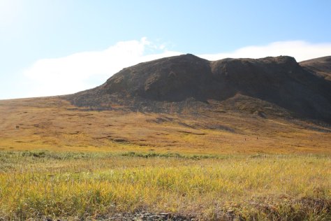
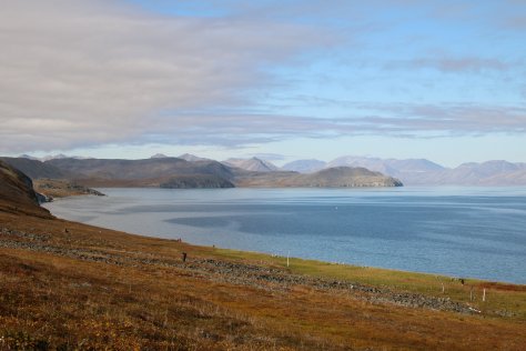
The landscape is stunning. Farther south than Wrangel there was correspondingly more vegetation, and the ground was awash in autumn colours.
AURORA
We had clear skies most nights, and were close enough to the equinox that it got properly dark. There were good auroral displays for six nights in succession, one of the best being as we sailed up Kolyuchin Inlet, with the sea so calm that the ship was an (almost) steady platform for photography.
HERALD ISLAND
From Wrangel, we sailed 70 kilometres eastwards to Herald Island. Herald is not much more than a ridge of rock rising from the sea, surrounded by steep cliffs and lumpy scree slopes along its whole nine-kilometre length.
There’s a small beach at its southeast end, from which I’m pretty sure you could access the spine of the island with just a bit of scrambling. At the northwest end, there’s a shore-line boulder-field on which four of the Karluk castaways found their way ashore from the pack ice in 1914, only to die under mysterious circumstances, their camp still full of food, their guns still provided with ammunition. So remote and inaccessible is this place, their bodies weren’t discovered for a decade. (I previously wrote about the Karluk shipwreck when I reported on our stay at Wrangel Island.)
We cruised in boats through sea ice to the south end of the island, and counted polar bears. At one point, there were more than thirty bears visible from our position just off the coast—clambering the scree, walking the ridge, snoozing on patches of snow. Herald is a great denning site for overwintering bears, but at this time of year they’ve got nothing much to do except wait for the sea-ice and the seals to return.
And we went ashore on the scrap of beach. There’s not much reason to land on Herald (unless you’re shipwrecked, of course). We landed because it’s something not many people get to do (far fewer people have set foot on Herald than on the summit of Everest) and also because it was freezing cold sitting in a boat under Herald’s cap of cloud and in the shadow of its cliffs, so it was nice to have a chance to jog around a bit to warm up.
THE DIOMEDES
The Diomede Islands sit in the Bering Strait between the easternmost point of the Russian mainland (Cape Dezhnev) and the westernmost point of the American mainland (Cape Prince of Wales). They’re about forty kilometres from both mainlands, and less than four kilometres apart. But they’re separated not just by an international border, but the Date Line as well—those meagre four kilometres bring not just a change of government, but a shift of four time zones and a change of date too, so that anyone who made the crossing would need to shift their watch by twenty hours.
Not many make the crossing, though. The Soviets relocated the Yupik residents of Big Diomede to the mainland, set up a Border Guard post at the north end of the island, and closed the border—disrupting what had until then been a trans-Bering Inuit community. On Little Diomede, a tiny community remains in the village of Diomede, with 200 inhabitants.
We weren’t permitted to land on Big Diomede (which the Russians call Ratmanov), or to cross the border to Little Diomede. We were permitted to cruise the boats along the north coast of the island, so long as we didn’t move out of sight of a Border Guard standing on an observation platform next to the station. Like anywhere in Russia, we weren’t allowed to take a photograph of the government buildings of the station (though you can find them easily enough on Google Earth). But we did give a yell and a wave to the little group of (presumably off-duty) men who came out to take a look at us, and got a yell and a wave back.
Every now and then, of course, as we dipped in and out of various inlets along the bird cliffs, we did move out of sight of the guard. We framed elaborate (and entirely theoretical) plans of how we could get someone ashore in those moments, replacing them with an inflatable dummy in the boat to keep the head-count correct. We weren’t sure what the point of that would be, but we’d all read too many Cold War spy thrillers not to consider it desirable as an end in itself. Thwarted on the espionage front, I contented myself with leaning out of the boat and slapping a Big Diomede rock in passing. Next best thing to a landing, really.
CULTURE
On Itygran Island we visited Whalebone Alley, a 600-year-old site in which whale bones are arrayed in a linear pattern extending for over half a kilometre along the shore, with ribs and jaw bones set up on end in the tundra. It’s clearly a ritual site of some kind, but no-one seems very sure of its significance.
At Cape Dezhnev, we walked through the atmospheric ruins of Naukan, an abandoned Yupik settlement. People lived here for centuries, on a tilted plateau perched above a gravel beach looking out on the chilly Bering Sea where they hunted for sea mammals. But the Naukan people were forcibly relocated by the Soviets in 1958, who pronounced their village “uninhabitable”, in the teeth of the evidence to the contrary. In the museum in Lavrentiya, we met a Yupik woman who had lived in Naukan as a small child, and still missed it.
In Lavrentiya, we found ourselves being photographed by the locals almost as much as we were photographing them, which was an interesting experience. In Lavrentiya, too, I heard unmistakable sounds from overhead, and stopped in the middle of the street to gaze up at a skein of migrating sandhill cranes passed overhead on their way to spend the winter somewhere near Mexico. Have a listen to their flight calls:
Used under CC BY-NC-SA 3.0 licence
Isn’t that an atmospheric sound?
AND FINALLY …
The flight home from Keflavik to Glasgow had one more holiday treat to offer. The flight path slants across the Hebrides of Scotland, and for the first time we had clear weather.
The show started when I caught sight of the Flannan Islands (location of a famous mystery disappearance) from my seat on the left of the plane. Craning to look ahead, I could see the whole of Lewis laid out ahead of me. Then we flew past Harris, looking down on Luskentyre Beach and Scarista Beach, where we’d walked earlier this year, then down the west coast of Skye, over Rum and Eigg, and then between Ardnamurchan and the Isle of Mull.
The cloud eventually close below us as we passed Ben Cruachan. Show over, and back to rainy Glasgow.
or


Wonderful. Wonderful ! Feel I’d been there with you. Unfortunately, don’t think I’d be able to get on/off zodiaks for all the super island or shore visits. Awesome animals. Told you before how partial I am to polar bears. Northern lights are on my bucket list A fascinating trip altogether.
You’re a good audience!
But, yes, it was a marvellous trip. I think a small ship is by far the best way of visiting these places.