Lorns Hill (NO 443399, 243m)
Dodd Hill (NO 452396, 255m)
Carrot Hill (NO 458401, 259m)
Labothie Hill (NO 472416, 232m)
10 kilometres
190 metres of ascent

Contains OS OpenData © Crown copyright and database right 2018
This low ridge is an outlier of the main Sidlaws range, and pretty much its eastern last gasp. It stands out on Google Earth as a little curved strip of moorland poking into the farmland east of the A90. I parked at the Carrot Hill viewpoint (NO 463408). When I was a child, Carrot Hill was an exotic, almost mythical place. My father would point it out as we drove past, and promise that some day we would climb it. I actually couldn’t see it, because I was looking for something more pointy, like … well, like a carrot, I suppose. The derivation of the name seems to be uncertain, and it is probably, like so many hills in the area, named after the farm that lies below it, rather than having earned a name for itself.

There’s a nice viewpoint indicator near the car park, identifying hills in the Sidlaws and the Angus glens beyond. There’s a bare 45m of ascent to the trig point on Carrot Hill, along a good path that runs alongside ugly felled woodland, and which seems to be a favourite place for dog-walkers to let their pets run free. (I have the footprints of a black labrador on my shoulders to prove it.) The summit also boasts a massive shelter cairn that wouldn’t be out of place above 1000m.


Beyond Carrot Hill, I began to shake off the dog walkers. There’s a broad track along the ridge to Dodd Hill (above Dodd Farm), with fine views over farmland all around, bordered by the Grampians to the north and the Tay estuary to the south. Dodd Hill has an eccentric conical cairn, which might have been better suited to Carrot.

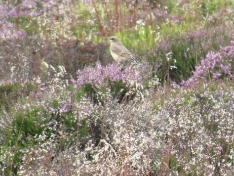
Beyond Dodd, I was into the wilds—no path, no dogs. The heather was knee-deep in places, and stepping over a couple of low fences seemed like a brief respite from the otherwise tough going. A deer bounded up the hill ahead of me, and a flock of wheatears settled briefly around me as I stood on Lorns’ empty, rounded summit. This hill gives the best impression of having a connection to the main Sidlaws ridge, looking across the A90 at Petterden towards Lumley Den, flanked by hills I’ve climbed before: Ironside and Finlarg.

Back the way I came, then, and across the car park and the road to look for access to Labothie Hill. (It’s above Labothie Farm—you see how this works?) Although there’s a track marked on the Ordnance Survey 1:25,000 map, it’s no more than a pair of deep ruts left by some forestry vehicle, now heavily overgrown with thistles and gorse. In a few years it will be unfindable and impassable*. But it takes you to a gate that lets out on to a pretty area of tree-dotted grassland, Bractullo Muir (breac tulach, “speckled hillock”, which pretty much sums up the appearance).
There were martins and swallows here, and more wheatears, and then a very large pair of wings and a forked tail overhead—a red kite! I had no idea that they’d made it this far east from their reintroduction site near Stirling. A red kite! I stood and smiled up at it, and it deigned to hang around overhead for a while, presumably accepting my admiration as no more than its due.

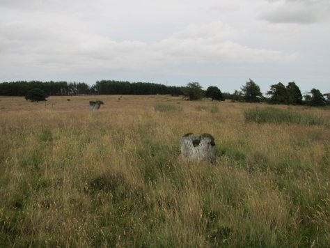
The ridge of Labothie Hill is an odd place, littered with the pits and mounds of prehistoric burial cairns (you can look through a list of them, starting from the entry for Hatton Cairn, on the Canmore website), punctuated by the stumps of sizeable felled trees.

I set off towards the east end of the ridge to take a look at another burial cairn there. But as I approached, I began to make out something large and concrete that wasn’t on my map. At first I thought it would be either the base of some decommissioned radio mast, or a water tank serving the buildings at the foot of the hill. But it wasn’t.

Canmore has this to say about it:
Pillbox (20th Century)
NO 47776 41885
A possible type 27 pillbox situated about 25m W of the remains of a prehistoric cairn.
A pillbox. A World War II anti-invasion defence, of the kind to be found mouldering at the back of various beaches around Britain. But this one is on top of a hill in rural Angus. That seemed odd.
There were a couple of sheep inside, and the floor was an inch-deep mire of mud and sheep droppings. Since I didn’t fancy being in a filthy enclosed space with two panicky horned animals, I decided not to go inside. But through the windows I could see a shaft of daylight in the middle of the dark internal space. So I climbed on to the roof (as you do under these circumstances) and peered down into a central well that contained what I thought was the mounting for a flagpole, but which turns out to be for a light antiaircraft gun.

Now that makes more sense than the “coastal defence” scenario I’d been running with. Further investigation suggests this was part of the antiaircraft defence that surrounded the World War II radar station at RAF Douglas Wood, the remains of which still lie just downhill from my pillbox.
And then I headed back to the car, arriving just as the rain started. An unexpected red kite, a very unexpected military installation, and a bit of snatched clear weather. What could be more satisfying?

* When access to Labothie Hill becomes impossible from the car park at Carrot Hill, it will still be easily accessible via the farm track that runs up from the B978, past the old RAF Douglas Wood buildings (which are now used by the Scouts). It’s a very dull and muddy walk up, unfortunately.
or
